21.09.2006
HRSC Produktserie #300 - Cydonia Orbit 3253
HRSC Press Release #300 - Cydonia (orbit 3253)
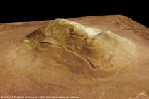
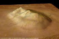
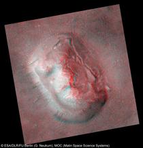
Cydonia-Region - "Das Gesicht auf dem Mars"
Cydonia-Region - "The Face on Mars"
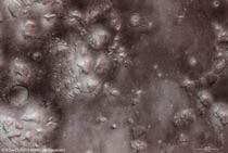
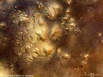
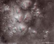
Am 22. Juli 2006 nahm die hochauflösende Stereokamera (HRSC), unter der Leitung des Principal Investigator Prof. Dr. Gerhard Neukum von der Freien Universität Berlin, auf der ESA-Sonde Mars Express im Orbit 3253 einen Teil der Region Cydonia mit einer Auflösung von ca. 13,7 Metern pro Bildpunkt auf. Die Abbildungen zeigen hiervon einen Ausschnitt bei 40,75° nördlicher Breite und 350,54° östlicher Länge.
On 22 July 2006 the High-Resolution Stereo Camera (HRSC), under the leadership of the Principal Investigator Prof. Dr. Gerhard Neukum of Freie Universitaet Berlin, onboard the ESA spacecraft Mars Express obtained image data in orbit 3253 with a ground resolution of approximately 13.7 meters per pixel. The data were acquired at approximately 40.75° northern latitude and 350.54° eastern longitude.
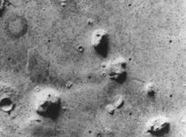
Die abgebildete Formation hat in den letzten 30 Jahren als "Gesicht auf dem Mars" Berühmtheit erlangt. Ausgangspunkt dafür war ein Foto der Cydonia Region vom 25. Juli 1976, aufgenommen vom amerikanischen Viking 1 Orbiter. Das Bild zeigte die für diese Region typischen abgerundeten Einzelberge, wobei eine dieser Formationen in der NASA-Pressemitteilung vom 31. Juli 1976 als "einem menschlichen Kopf ähnlich" beschrieben wird (siehe Viking 1 Aufnahme). Bereits zu diesem Zeitpunkt ging man von einer optischen Täuschung aus, die bedingt durch Sonnenstand, die Obenflächenform und der aus beiden resultierenden Schattenbildung der Formation Augen, Nase und Mund verlieh.
Triggered by a photo of the Cydonia region, taken on 25 July 1976 by the American Viking 1 Orbiter, one of the visible remnant massifs became famous in the last 30 years as "Face on Mars". It was first publicly labelled as "resembling a human head" in the NASA press release on 31 July 1976 (see Viking 1 image). Then NASA scientists already interpreted the formation as an optical illusion caused by the illumination angle of the sun, the surface morphology and the resulting shadows, giving the impression of eyes, nose and mouth.
In den folgenden Jahren war das "Gesicht auf dem Mars" Grund für zahlreiche Spekulationen über künstliche Strukturen auf dem Mars, deren möglichen Ursprung und ihren eventuellen Zweck. Das Marsgesicht ist dabei die berühmteste Formation in einer Reihe von Strukturen, die von manchen Weltraum-Enthusiasten als mutmaßlich künstliche Landschaften, wie potentielle Pyramiden und sogar eine zerfallene Stadt, interpretiert wurden. Die Vorstellung, dass der Mars früher Lebensraum intelligenter Lebewesen gewesen sein könnte, beflügelte die Phantasie einer Reihe von Interessierten und fand ihren Ausdruck in zahlreichen mehr oder weniger ernsthaften Zeitungsartikeln, in Werken der Science-Fiction Literatur, in TV-Beiträgen, in Computerspielen und auf einer Vielzahl von Webseiten.
Nevertheless, in the following years, the "Face on Mars" was cause for numerous speculations about artificial structures on Mars, their possible origin and purpose. The "Face on Mars" is the most famous formation in an array of structures which have been interpreted by some space-enthusiasts as artificial landscapes, such as potential pyramids and even a disintegrated city. The idea that Mars could have been home to intelligent beings inspired the imagination of many people interested in Mars and was expressed in numerous, more or less serious, newspaper articles, in Science Fiction literature, in TV-contributions, in computer-games and on many webpages.
Die offizielle Lesart der Wissenschaftler hat sich dabei nie geändert: das Gesicht auf dem Mars blieb ein rein optisches Phänomen, bedingt durch Schattenwurf auf einer durch natürliche Erosion geformten Oberfläche. Erst im April 1998 konnte dieser Standpunkt mit Hilfe weiterer Bilddaten der Mars Orbiter Camera auf der NASA-Mission Mars Global Surveyor bekräftigt werden. Auch spätere Aufnahmen derselben Sonde im Jahre 2001 bestätigten diese Interpretation.
The official scientific interpretation has never changed: the Face on Mars has remained an optical phenomenon caused by shadow on a heavily eroded surface. It took until April 1998, when further image data of the Mars Orbiter Camera on the NASA mission Mars Global Surveyor, helped to confirm this view. Also data of the same orbiter in the year 2001 have verified this interpretation.
|
|
Die HRSC auf der ESA Sonde Mars Express hat zwischen April 2004 und Juli 2006 bereits mehrmals Daten in der Cydonia Region aufgenommen. Doch große Überflughöhen, die in geringer Bildauflösung am Boden resultieren (Orbit 0262, Orbit 2533, Orbit 2872), sowie Staub und Dunst in der Atmosphäre, die zu stark verminderter Bildqualität führen (Orbit 1216, Orbit 2872), haben die Aufnahme von hochwertigen Bilddaten durch HRSC in Cydonia verhindert. Am 22. Juli 2006 hatte das HRSC Team im Orbit 3253 endlich Erfolg. Ein großes Gebiet in Cydonia konnte in bester Auflösung und in 3D aufgenommen werden.
Between April 2004 and July 2006, the HRSC experiment on the ESA Mars Express orbiter acquired data in the Cydonia region multiple times. However, high flight altitude, resulting in poor data resolution at the ground (orbit 0262, orbit 2533, orbit 2872), as well as dust and haze in the Martian atmosphere, leading to heavily reduced data quality (orbit 1216, orbit 2872) mostly prevented the acquisition of high-quality data of the Cydonia region. On 22 July 2006, the HRSC has finally been successful in orbit 3253. A wide area in Cydonia could be covered in best possible resolution and in 3D.
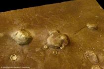
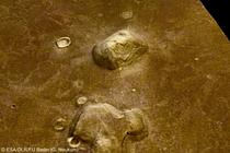
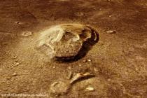
Cydonia liegt in der Region Arabia Terra und gehört zur Übergangszone zwischen den südlichen Mars-Hochländern und den nördlichen Mars-Tiefländern. Diese Übergangszone, auch unter der Bezeichnung Dichotomie-Grenze bekannt, ist durch breite schuttgefüllte Täler und Einzelberge unterschiedlicher Größe und Form charakterisiert. In Nachbarregionen von Cydonia sind diese Einzelberge an ihrem Fußbereich oft von Halden aus Schutt, wahrscheinlich mit einem Gehalt an Wassereis, umgeben. An einigen vergleichsweise kleinen Restbergen in Cydonia fehlen diese Schutthalden. Die Morphologie der Schutthalden wird durch Details der Hangrutschungsprozesse beeinflusst. Die Marsgesicht-Formation weißt einen solchen charakteristischen Bergrutsch und ein frühes Stadium einer Schutthalde auf. Frühere größere Rutschungen könnten durch spätere Lavaüberflutungen in der Umgebung überdeckt worden sein. Die westliche Wand des "Marsgesichtes" ist als zusammenhängende Masse hangabwärts gerutscht. Die Abbruchzone ist deutlich als große von Norden nach Süden verlaufende Abrisskante zu erkennen. Auch an der Basis der Pyramiden-Formationen sind die Ergebnisse von Hangrutschungsprozessen erkennbar.
The Cydonia region is located in the Arabia Terra region on Mars and belongs to the transition zone between the southern highlands and the northern plains of Mars. This transition, the so-called dichotomy boundary, is characterized by wide debris-filled valleys and isolated remnant mounds of various sizes and shapes. In areas adjacent to Cydonia, debris aprons are frequently found, and which formed at the foot of such remnant mounds and probably consist of a mixture of rocky debris and ice. In Cydonia such aprons are often missing in smaller massifs. The formation of debris aprons is considered to be controlled by talus formation and landslides. At the 'Face of Mars' such characteristic landslides and an early form of debris apron formation can also be observed. Former larger debris aprons might have been covered up by later lava flows in the surroundings. The western wall of the "Face" moved downslope as a coherent mass. The location of the detachment zone is reflected by a large scarp extending from north to south. The results of large mass wasting are also visible at the foot of the pyramid-like formations.
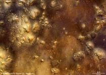
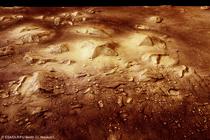
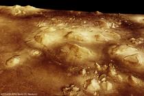
Bereits beim ersten Blick auf die Bilddaten fällt nördlich der "Pyramiden" in direkter Nachbarschaft zum "Marsgesicht" eine totenkopf-förmige Struktur auf. Diese wurde bei der Auswahl der Bildszenen entsprechend berücksichtigt.
In addition to the well known "Face on Mars" and the "Pyramids", a skull-like structure is visible in between. It is accordingly taken into account by the selection of the image scenes.
Die Farbansichten wurden aus dem senkrecht blickenden Nadirkanal und den Farbkanälen erstellt, die Schrägansicht wurde aus den Stereokanälen der HRSC berechnet. Die Anaglyphen werden aus dem Nadirkanal und einem Stereokanal abgeleitet. Die schwarzweißen Detailaufnahmen wurden dem Nadirkanal entnommen, der von allen Kanälen die höchste Auflösung zur Verfügung stellt.
The colour scenes have been derived from the three HRSC-colour channels and the nadir channel. The
perspective views have been calculated from the digital terrain model derived from the
stereo channels. The anaglyph image was calculated from the nadir and one stereo channel.
The black and white high resolution images were derived form the nadir channel which provides the
highest detail of all channels.
Das Kameraexperiment HRSC auf der Mission Mars Express der
Europäischen Weltraumorganisation ESA wird vom Principal Investigator Prof. Dr.
Gerhard Neukum (Freie Universität Berlin), der auch die technische Konzeption der
hochauflösenden Stereokamera entworfen hatte, geleitet. Das
Wissenschaftsteam besteht aus 40 Co-Investigatoren aus 33 Institutionen und zehn
Nationen. Die Kamera wurde am Deutschen Zentrum für Luft- und Raumfahrt (DLR) unter der
Leitung des Principal Investigators (PI) G. Neukum entwickelt und in Kooperation mit
industriellen Partnern gebaut (EADS Astrium, Lewicki Microelectronic GmbH und Jena
-Optronik GmbH). Sie wird vom DLR -Institut für Planetenforschung in Berlin-Adlershof
betrieben. Die systematische Prozessierung der Daten erfolgt am DLR. Die Darstellungen
wurden vom Institut für Geologische Wissenschaften der FU Berlin in Zusammenarbeit
mit dem DLR-Institut für Planetenforschung erstellt.
The High Resolution Stereo Camera (HRSC) experiment on the ESA Mars Express Mission is led by the
Principal Investigator (PI) Prof. Dr. Gerhard Neukum who also designed the camera technically. The
science team of the experiment consists of 40 Co-Investigators from 33 institutions and 10 nations.
The camera was developed at the German
Aerospace Center (DLR) under
the leadership of the PI G. Neukum and built in cooperation with industrial partners (EADS
Astrium, Lewicki Microelectronic GmbH and Jena-Optronik GmbH). The experiment on Mars Express
is operated by the DLR Institute of Planetary Research, through ESA/ESOC. The systematic
processing of the HRSC image data is carried out at DLR. The scenes shown here were created
by the PI-group at the Institute for Geological Sciences of the Freie Universitaet Berlin in
cooperation with the German Aerospace Center (DLR), Institute of Planetary Research, Berlin.
Download
hochaufgelöste Bilddaten / high resolution image data
| #vk1 Graustufenbild, (Quelle: NASA JPL Viking Press Release P-17384; Viking 1 Orbiter Bild 35A72): | TIF
(320 KBs) | JPG
(67 KBs) | |
| Kontextkarte [2]: | TIF
(5 MBs) | JPG
(170 KBs) | |
| #nd1 Graustufenbild, groß, (Daten: HRSC Orbit 3253 (Nadir)): | TIF
(17 MBs) | JPG
(3 MBs) | |
| #co1 RGB Farbszene, groß, (Daten: HRSC Orbit 3253 (Nadir), HRSC Orbit 1216 (RGB)): | TIF
(52 MBs) | JPG
(5 MBs) | |
| #co2 RGB Farbszene, Teilbereich, (Daten: HRSC Orbit 3253 (Nadir), HRSC Orbit 1216 (RGB)): | TIF
(53 MBs) | JPG
(5 MBs) | |
| #an1 Anaglyphe Szene, groß, (Daten: HRSC Orbit 3253 (Nadir, Stereo)): | TIF
(57 MBs) | JPG
(6 MBs) | |
| #an2 Anaglyphe Szene, Teilbereich, (Daten: HRSC Orbit 3253 (Nadir, Stereo)): | TIF
(15 MBs) | JPG
(2 MBs) | |
| #an3 Anaglyphe Szene, Teilbereich, (Daten: HRSC Orbit 3253 (Nadir, Stereo)): | TIF
(3 MBs) | JPG
(283 KBs) | |
| #an4 Anaglyphe Szene, 'Marsgesicht', (Daten: HRSC Orbit 3253 (Nadir), MOC Bild E03-00824 (credit: Malin Space Science Systems)): | TIF
(5 MBs) | JPG
(243 KBs) | |
| #3d1 Perspektivische Szene, 'Pyramiden' und 'Totenkopf', (Daten: HRSC Orbit 3253 (Nadir, DTM), HRSC Orbit 1216 (RGB)): | TIF
(26 MBs) | JPG
(3 MBs) | |
| #3d2 Perspektivische Szene, 'Pyramiden' und 'Totenkopf', (Daten: HRSC Orbit 3253 (Nadir, DTM), HRSC Orbit 1216 (RGB)): | TIF
(28 MBs) | JPG
(3 MBs) | |
| #3d3 Perspektivische Szene, 'Marsgesicht', (Daten: HRSC Orbit 3253 (Nadir, DTM), HRSC Orbit 1216 (RGB)): | TIF
(4 MBs) | JPG
(351 KBs) | |
| #3d4 Perspektivische Szene, 'Marsgesicht', (Daten: HRSC Orbit 3253 (Nadir, DTM), HRSC Orbit 1216 (RGB)): | TIF
(8 MBs) | JPG
(342 KBs) | |
| #3d5 Perspektivische Szene, 'Marsgesicht', (Daten: HRSC Orbit 3253 (Nadir, DTM), HRSC Orbit 1216 (RGB), MOC Bild E03-00824 (credit: Malin Space Science Systems)): | TIF
(48 MBs) | JPG
(1 MB) | |
| #3d6 Perspektivische Szene, 'Marsgesicht', (Daten: HRSC Orbit 3253 (Nadir, DTM), HRSC Orbit 1216 (RGB), MOC Bild E03-00824 (credit: Malin Space Science Systems)): | TIF
(48 MBs) | JPG
(1 MB) | |
| #3d7 Perspektivische Szene, 'Totenkopf', (Daten: HRSC Orbit 3253 (Nadir, DTM), HRSC Orbit 1216 (RGB)): | TIF
(7 MBs) | JPG
(637 KBs) | |
© Copyright: ESA/DLR/FU Berlin (G. Neukum)
![Nadiraufnahme [5]](./preleases/300/thumbs/300-230906-3253-6-nd1-Cydonia.jpg)
![Kontextkarte [2]](./preleases/300/thumbs/300-230906-3253-6-ctxt1-Cydonia.jpg)

 English

