Navigation/Menü: Links auf weitere Seiten dieser Website und Banner
08.09.2005
HRSC Press Release #213 - Volcano Biblis Patera (orbit 1034)
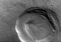
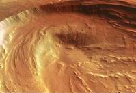 Am 8. November 2004 nahm die hochauflösende Stereokamera (HRSC) auf der ESA
-Sonde Mars Express im Orbit 1034 einen Teil der Region von Biblis Patera mit
einer Auflösung 10,8m pro Bildpunkt auf. Die Abbildungen zeigen hiervon einen
Ausschnitt bei 2° nördlicher Breite und 236° östlicher Länge.
On 8 November 2004 the High-Resolution Stereo Camera (HRSC) onboard the ESA
spacecraft Mars Express obtained image data in Orbit 1034 with a ground
resolution of approximately 10.8 metres per pixel. The data were acquired in the
region of Biblis Patera, at approximately 2° northern latitude and 236° eastern
longitude.
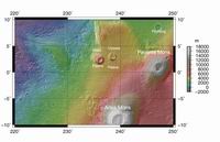 Der im westlichen Bereich der Tharsis-Aufwölbung gelegene Vulkan Biblis Patera
liegt zwischen den Tharsis Montes im Osten und Olympus Mons im Westen. Er ist
ungefähr 170 km lang, 100 km breit und erhebt sich 2 bis 3 km über seine
Umgebung. Die Caldera, der ausgedehnte Gipfelkrater des Vulkans, hat sich
vermutlich durch das Einbrechen der Magmakammer während vulkanischer Eruptionen
gebildet. Die Caldera von Biblis Patera hat einen Durchmesser von 53 Kilometern
und eine Tiefe von ungefähr 4,5 km.
Located in the western part of the Tharsis rise between Olympus Mons and Tharsis
Montes, the volcano Biblis Patera is 170 km long, 100 km wide and rises 2 to 3
km high above its surroundings. The bowl-shaped depression, known as a caldera,
may have been formed as the result of collapse of the magma chamber during
eruptions of the volcano. The caldera of Biblis Patera has a diameter of 53 km
and extends to a maximum depth of roughly 4.5 km.
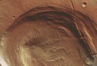 Die konzentrischen Stufen im Inneren der Caldera deuten darauf hin, dass sie
durch mehrere Kollaps-Ereignisse entstanden ist. Die von der Caldera ausgehenden
radialen Senken und die konzentrischen Strukturen sind wahrscheinlich
tektonische Störungen, die während der Entstehung des Vulkans gebildet wurden.
Im Südwesten des Vulkans sind Störungen zu erkennen, die von Nordwesten nach
Südosten verlaufen; ihre Entstehung hängt vermutlich mit der Bildung der
Tharsis-Aufwölbung zusammen. Im Nordosten der Caldera ist eine Wolke zu sehen,
welche die Oberfläche teilweise verhüllt und einen deutlich helleren, weniger
rötlichen Farbton hat.
The morphology of the caldera suggests that multiple collapse events have
occurred. The radial depressions and faint concentric circles on the flanks of
the volcano are most likely faults associated with the formation of Biblis
Patera. In the southwest, the linear features trending northwest to southeast
appear to be faults. In the regions surrounding Biblis Patera, there are more
faults with a similar orientation and which may be related to the formation of
the Tharsis Rise. Biblis Patera is older than the surrounding plains, which
consist of lava flows originating from Pavonis Mons (the middle one of the
Tharsis Montes volcanoes). To the northeast of the caldera, clouds obscure the
surface, making it appear less of a reddish-orange colour.
 Die Stereo- und Farbfähigkeiten verbunden mit der hochauflösenden Abdeckung
großer Gebiete der HRSC bieten neue Möglichkeiten, die komplexe geologische
Geschichte des roten Planeten zu erforschen. Durch die neuen Bilddaten von
Vulkanen wie Biblis Patera wird es den Wissenschaftlern ermöglicht, die
Entwicklung der Morphologie und des Vulkanismus auf dem Mars besser zu
verstehen. So ermöglicht es die HRSC- Kamera in Verbindung mit den anderen
Instrumenten an Bord der Sonde Mars Express und unter Einbeziehung von Daten
anderer Missionen, unser Verständnis diesen faszinierenden Planeten zu
verbessern.
The stereo and colour capability and the high resolution coverage of extended
areas of the HRSC camera allows for improved study of the complex geologic
evolution of the red planet. By supplying new image data for volcaones like
Biblis Patera, the HRSC camera provides scientists with the opportunity to
better understand the morphology and volcanic history of Mars. Data from the
HRSC camera, coupled with information from other instruments on Mars Express and
other missions, improves our understanding of this fascinating planet.
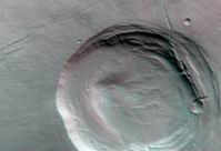
Die Farbansichten wurden aus dem senkrecht blickenden Nadirkanal und den Farbkanälen erstellt, die Schrägansicht wurde aus den Stereokanälen der HRSC berechnet. Die Anaglyphen werden aus dem Nadirkanal und einem Stereokanal abgeleitet. Die schwarzweißen Detailaufnahmen wurden dem Nadirkanal entnommen, der von allen Kanälen die höchste Auflösung zur Verfügung stellt.
 The colour scenes have been derived from the three HRSC-colour channels and the nadir channel. The
perspective views have been calculated from the digital terrain model derived from the
stereo channels. The anaglyph image was calculated from the nadir and one stereo channel.
The black and white high resolution images were derived form the nadir channel which provides the
highest detail of all channels.
Das Kameraexperiment HRSC auf der Mission Mars Express der Europäischen Weltraumorganisation ESA wird vom Principal Investigator Prof. Dr. Gerhard Neukum (Freie Universität Berlin), der auch die technische Konzeption der hochauflösenden Stereokamera entworfen hatte, geleitet. Das Wissenschaftsteam besteht aus 40 Co-Investigatoren aus 33 Institutionen und zehn Nationen. Die Kamera wurde am Deutschen Zentrum für Luft- und Raumfahrt (DLR) unter der Leitung des Principal Investigators (PI) G. Neukum entwickelt und in Kooperation mit industriellen Partnern gebaut (EADS Astrium, Lewicki Microelectronic GmbH und Jena -Optronik GmbH). Sie wird vom DLR -Institut für Planetenforschung in Berlin-Adlershof betrieben. Die systematische Prozessierung der Daten erfolgt am DLR. Die Darstellungen wurden vom Institut für Geologische Wissenschaften der FU Berlin in Zusammenarbeit mit dem DLR-Institut für Planetenforschung erstellt.
The High Resolution Stereo Camera (HRSC) experiment on the ESA Mars Express Mission is led by the Principal Investigator (PI) Prof. Dr. Gerhard Neukum who also designed the camera technically. The science team of the experiment consists of 40 Co-Investigators from 33 institutions and 10 nations. The camera was developed at the German Aerospace Center (DLR) under the leadership of the PI G. Neukum and built in cooperation with industrial partners (EADS Astrium, Lewicki Microelectronic GmbH and Jena-Optronik GmbH). The experiment on Mars Express is operated by the DLR Institute of Planetary Research, through ESA/ESOC. The systematic processing of the HRSC image data is carried out at DLR. The scenes shown here were created by the PI-group at the Institute for Geological Sciences of the Freie Universitaet Berlin in cooperation with the German Aerospace Center (DLR), Institute of Planetary Research, Berlin.
Download
hochaufgelöste Bilddaten / full resolution image data
Kontextkarte (MOLA) / Context Map (MOLA) | download TIF ( 3.5 MBs ) |
Nadiraufnahme / Grayscale Nadir Image | download TIF ( 16.6 MBs ) |
RGB Farbbild / RGB Colour Image | download TIF ( 25.5 MBs ) |
Rot-Cyan Anaglyphe #1 / Red-cyan anaglyphe #1 | download TIF ( 49.8 MBs ) |
Perspektive / Perspective view | download TIF ( 46.7 MBs ) |

 English

