Navigation/Menü: Links auf weitere Seiten dieser Website und Banner
24.03.2005
HRSC Press Release #173 - Medusae Fossae Formation (orbit 0917)
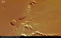 Am 06.10.2004 nahm die hochauflösende Stereokamera (HRSC) auf der ESA-Sonde Mars
Express im Orbit 917 einen Teil der
Medusae Fossae Formation mit einer Auflösung von etwa 13 Metern pro Bildpunkt
auf. Die Abbildungen zeigen einen Ausschnitt bei 5° südlicher Breite und 213°
östlicher Länge.
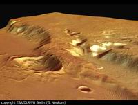
On 6 October 2004 the High-Resolution Stereo Camera (HRSC) onboard the ESA spacecraft Mars Express obtained image data of part of the Medusae Fossae Formation and adjacent areas at the highland-lowland boundary in orbit 917 with a ground resolution of approximately 13 metres per pixel. The images cover a segment at about 5? southern latitude and 213 eastern longitude.
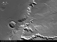 Die Medusae Fossae Formation erstreckt sich zwischen den vulkanischen Zentren um
Tharsis und Elysium entlang der Dichotomiegrenze. Der Ursprung dieser Formation
ist unklar. Hier ist ein Teil des alten vulkanischen Hochlandplateaus und die
Grenze zu Amazonis Sulci, einem Teil der Medusae Fossae Formation dargestellt.
Im Allgemeinen zeigt sich die Formation als glatte, leicht wellige Oberfläche.
In einigen Gebieten hat Wind die Oberfläche geformt und Riefen und Rücken
hinterlassen. Einen Eindruck erhält man, wenn man das Nadir-Mosaik betrachtet.
Es ist allgemein anerkannt, dass die Formation durch pyroklastische Ströme oder
andere vulkanische Auswurfmassen entstanden ist. Die Plateauwände sind teilweise
mit Lavaströmen überdeckt, teilweise von Tälern zerschnitten, die wahrscheinlich
durch fließendes Wasser entstanden sind. Am Fuß der Steilhänge und in den Tälern
sind kleine Kanäle zu sehen, die auf fließendes Wasser hindeuten. Da sie
teilweise von den Fließfronten der pyroklastischen Ströme überlagert sind, kann
man schließen, dass die Wassererosion vor deren Ablagerung endete. Später ist
der Einschlagskrater nahe dem Massiv entstanden, dessen Auswurfsmassen sich
ähnliche wie ein Schlammstrom über Teile des Massivs ergossen haben. Diese Form
der Auswurfmassen deuten an, dass Wasser oder Eis im Untergrund zur Zeit des
Einschlags vorhanden gewesen sein muss.
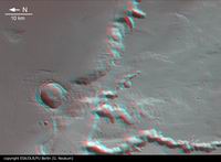 The Medusae Fossae Formation is an extensive unit of somewhat enigmatic origin
found near the Martian highland-lowland dichotomy boundary between the Tharsis
and Elysium volcanic centers. Here the boundary between the old volcanic plateau
region and Amazonis Sulci part of the widespread deposits of the Medusae Fossae
Formation (MFF) are shown. In general the formation appears as a smooth and
gently undulating surface, but is partly wind-sculptured into ridges and
grooves, as shown in the mosaicked nadir images. It is commonly agreed that the
materials forming Medusae Fossae were deposited by pyroclastic flows or similar
volcanic air falls. The plateau walls of the volcanic massif are partly covered
by lava flows and partly dissected by valleys which were most likely carved by
fluvial activity. The remains of water-bearing inner channels are visible in the
center of the valleys and at the bottom of the massif. Superposition of the
lobate-fronted pyroclastic flows indicate that the water erosion ended before
their deposition. Later a bolide impacted near the massif and the ejecta were
spread as a flow over parts of the plateau implying water or ice was present in
the subsurface at the time of impact.
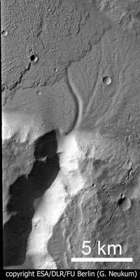
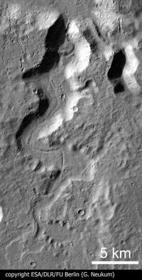 Detail #1
Die Hochland-Tiefland-Grenze (Dichotomy). Das vulkanische Plateau wurde vor
allem von Arsia Mons dem südlichsten der drei Tharsis Montes Vulkane gefüttert.
In diesem Bereich ist es von vielen Tälern zerschnitten. In dem Tal Senus Vallis
sieht man den kleinen inneren Kanal besonders gut.
The boundary of the highland-lowland. Here the volcanic plateau fed by the
southernmost Tharsis Montes volcano Arsia Mons, is dissected by several valleys
which were most likely carved by running water. Senus Vallis, a small example,
is shown in detail where the latest-stage inner channel is still visible.
Detail #2
Der Mund des Abus Vallis. Ein Tal, ähhnlich wie in Detail 1, allerdings sind hier die Wände so steil oder das Tal so eng, dass der inneren Kanal in dieser Beleuchtung im Schatten liegt. Man kann den Kanal, der auf eine späte Phase der Wasseraktivität hindeutet, am Fusse des Massivs verfolgen. In diesem Detail ist auch die spätere Überlagerung eines pyroklastischen Stromes zu sehen. Eindeutig zu erkennen ist, dass die Wassererosion vor der Ablagerung des vulkanischen Materials beendet war.The mouth of Abus Vallis a channel of the same type as the example in detail 1 is shown. Here the walls are too steep or the valley too narrow to look down to the bottom of the channel due to insolation and shading of the image, but the remains of the last stage of water activity can be traced as a small channel at the floor of the lowland plain. Additionally the emplacement of pyroclastic flows is visible in this detail. It shows that the action of water erosion ended before the emplacement of the pyroclastic flow.
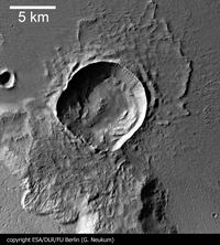 Detail #3
Diese Einschlagskrater ist das jüngste Merkmal diese stratigraphischen Folge. Er
hat eine sehr gut erhaltene Auswurfdecke, die sich durch ihre Lappenform
auszeichnet, und ein Anhaltspunkt für Wasser oder Eis im Untergrund bei der
Entstehung des Kraters ist. Diese Krater weicht von seiner typischen runden Form
ab, da sie sich beim Einschlag auf diesem unebenen Gebiet nicht vollständig
ausbilden konnte. Die Verteilung des Auswurfmaterials ähnelt
Schmetterlingsflügeln und ist ein Zeichen dafür, dass das Projektil nicht
senkrecht ein geschlagen ist, sondern unterhalb von 45 Grad.
An impact crater shown in this third detail is the youngest feature of the
stratigraphic sequence which can be observed in this image. This crater has a
well preserved ejecta blanket with a lobate appearance, which is believed to
indicate the presence of water or water ice in the impacted target. As a crater
forms on a flat surface, it expands in a circular fashion. Due to the
topography of the impact site the shape of the crater during expansion was
disturbed by the walls of the plateau and resulted in a somewhat asymmetric
(deviating from a circular) shape. The distribution of ejecta resembling the
wings of a butterfly, is due to a non-vertical impact (less than 45 degree).
Detail #4
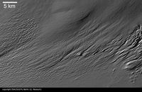
Amazonis Sulci, ein Teil der Medusae Fossae Formation, ist durch Wind mir Riefen und Rücken überzogen. Da man fast keine Krater überlagert sieht, bedeutet das, dass die Winderosion der letzte oberflächenformende Prozess war.The Amazonis Sulci appears wind-sculptured, visible in ridges and grooves. Almost no crater is superposing this surface and indicate that the wind erosion has been the latest stage of erosional processes acting here.
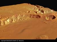 Die Farbansichten wurden aus dem senkrecht blickenden Nadirkanal und den Farbkanälen erstellt, die Schrägansicht wurde aus den Stereokanälen der HRSC berechnet. Die Anaglyphen werden aus dem Nadirkanal und einem Stereokanal abgeleitet. Die schwarzweißen Detailaufnahmen wurden dem Nadirkanal entnommen, der von allen Kanälen die höchste Auflösung zur Verfügung stellt.
The colour scenes have been derived from the three HRSC-colour channels and the nadir channel. The perspective views have been calculated from the digital terrain model derived from the stereo channels. The anaglyph image was calculated from the nadir and one stereo channel. The black and white high resolution images were derived form the nadir channel which provides the highest detail of all channels.
 Das Kameraexperiment HRSC auf der Mission Mars Express der
Europäischen Weltraumorganisation ESA wird vom Principal Investigator Prof. Dr.
Gerhard Neukum (Freie Universität Berlin), der auch die technische Konzeption der
hochauflösenden Stereokamera entworfen hatte, geleitet. Das
Wissenschaftsteam besteht aus 40 Co-Investigatoren aus 33 Institutionen und zehn
Nationen. Die Kamera wurde am Deutschen Zentrum für Luft- und Raumfahrt (DLR) unter der
Leitung des Principal Investigators (PI) G. Neukum entwickelt und in Kooperation mit
industriellen Partnern gebaut (EADS Astrium, Lewicki Microelectronic GmbH und Jena
-Optronik GmbH). Sie wird vom DLR -Institut für Planetenforschung in Berlin-Adlershof
betrieben. Die systematische Prozessierung der Daten erfolgt am DLR. Die Darstellungen
wurden vom Institut für Geologische Wissenschaften der FU Berlin in Zusammenarbeit
mit dem DLR-Institut für Planetenforschung erstellt.
The High Resolution Stereo Camera (HRSC) experiment on the ESA Mars Express Mission is led by the Principal Investigator (PI) Prof. Dr. Gerhard Neukum who also designed the camera technically. The science team of the experiment consists of 40 Co-Investigators from 33 institutions and 10 nations. The camera was developed at the German Aerospace Center (DLR) under the leadership of the PI G. Neukum and built in cooperation with industrial partners (EADS Astrium, Lewicki Microelectronic GmbH and Jena-Optronik GmbH). The experiment on Mars Express is operated by the DLR Institute of Planetary Research, through ESA/ESOC. The systematic processing of the HRSC image data is carried out at DLR. The scenes shown here were created by the PI-group at the Institute for Geological Sciences of the Freie Universitaet Berlin in cooperation with the German Aerospace Center (DLR), Institute of Planetary Research, Berlin.
© Copyright: ESA/DLR/FU Berlin (G. Neukum)
Download
hochaufgelöste Bilddaten / full resolution image data
Nadiraufnahme / Grayscale Nadir Image | download TIF ( 17.3 MBs ) |
Nadiraufnahme (Detail) / Nadir Image (detail) #2 | download TIF ( 2.8 MBs ) |
Nadiraufnahme (Detail) / Nadir Image (detail) #3 | download TIF ( 1.6 MBs ) |
Nadiraufnahme (Detail) / Nadir Image (detail) #4 | download TIF ( 3.9 MBs ) |
Nadiraufnahme (Detail) / Nadir Image (detail) #5 | download TIF ( 9.8 MBs ) |
RGB Farbbild / RGB Colour Image | download TIF ( 97.5 MBs ) |
Rot-Cyan Anaglyphe / Red-cyan anaglyphe | download TIF ( 52 MBs ) |
Perspektive / Perspective view | download TIF ( 104.2 MBs ) |
Perspektive #2 / Perspective view #2 | download TIF ( 79 MBs ) |

 English

