 Deutsch

Navigation/Menü: Links auf weitere Seiten dieser Website und Banner
04.07.2013
Lava flows at the foot of Olympus Mons
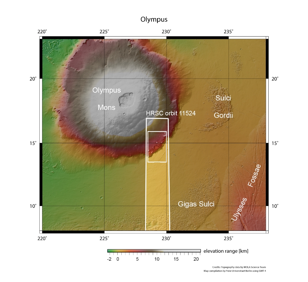
On 21 January 2013, the High Resolution Stereo Camera (HRSC), operated by the German Aerospace Center (Deutsches Zentrum für Luft- und Raumfahrt; DLR) on board ESAâs Mars Express spacecraft, imaged the southeast portion of the Olympus Mons shield volcano, the largest volcano in the Solar System, located approximately 200 kilometers southwest of the Sulci Gordii region.
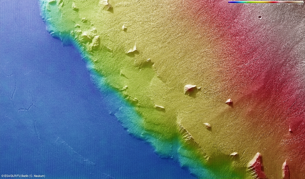
Shield volcanoes are formed almost entirely of fluid lava flows. They are named for their large areal size and low profile, resembling a warriorâs shield. This shape is due to the low viscosity lava they erupt, which travels farther than lava spewed by more explosive volcanoes. These flows result in the steady accumulation of broad sheets of solidified lava, building up the shield volcanoâs distinctive shape. The upper surface of the shield, the prominent scarp, and the flat lava plain at the base are clearly discernable in the topographic image, where elevation data is shown using false colours.
Unique scarp
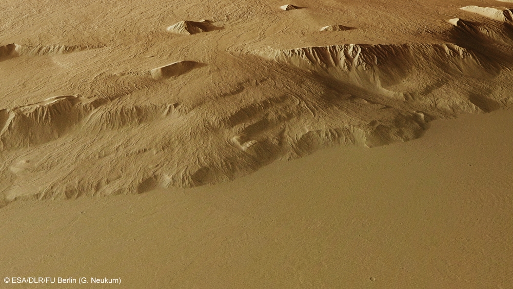
The circumferential scarp of the 22-kilometre-high volcano is unique and, in places, is up to nine kilometres high. In some places, it has been partially overflown by lava emanating from the upper shield and elsewhere its base has been partially buried by external lava flows. Where geological processes have not modified the scarp, the slope inclination exceeds 20 degrees. A number of both pointed and flat-topped blocks or mesas can be seen emerging from the surrounding lava field. These blocks were either rotated or uplifted when the outer flanks of Olympus Mons collapsed to form the scarp.
Young lava flows
A large number of individual lava flows can be observed on the upper shield and on the scarp. Flows that ended before reaching the scarp did so with rounded tongues, as the lava cooled and crept to a stop. The narrow lava flows clearly show their characteristic morphology, consisting of steep lobate margins, levees and channels. Lava tubes are also present in this scene and form small ridges with partially exposed channel segments. Where lava flows have cascaded down the scarp they have formed broad lava fans, which have been partially buried by the lava flows that formed the flat lava plain at the base of the scarp. From the superposition of the flows, it is clear that the lava plain is younger than the shield-sourced lava flows, but the virtual absence of impact craters on the lava flows indicate that they were formed in the recent history of the volcano.
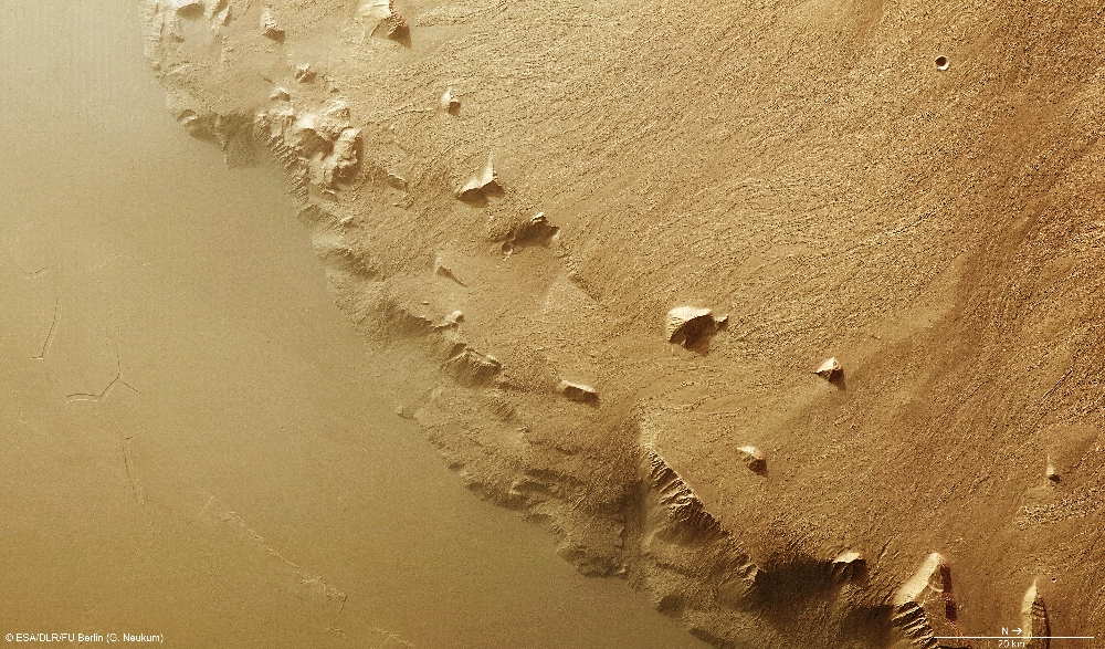
The lava plain features wrinkle ridges, a channel system, and individual broad lava flows. The latter are barely visible and do not have well-preserved surface textures. The channel system to the southeast (lower left in the nadir images) was carved by fluids. Material emanating to the east can still be observed. It is likely that lava carved the channels; however, a fluvial origin with transported sediments cannot be ruled out.
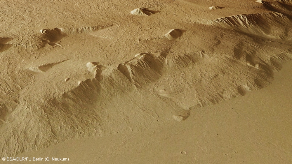
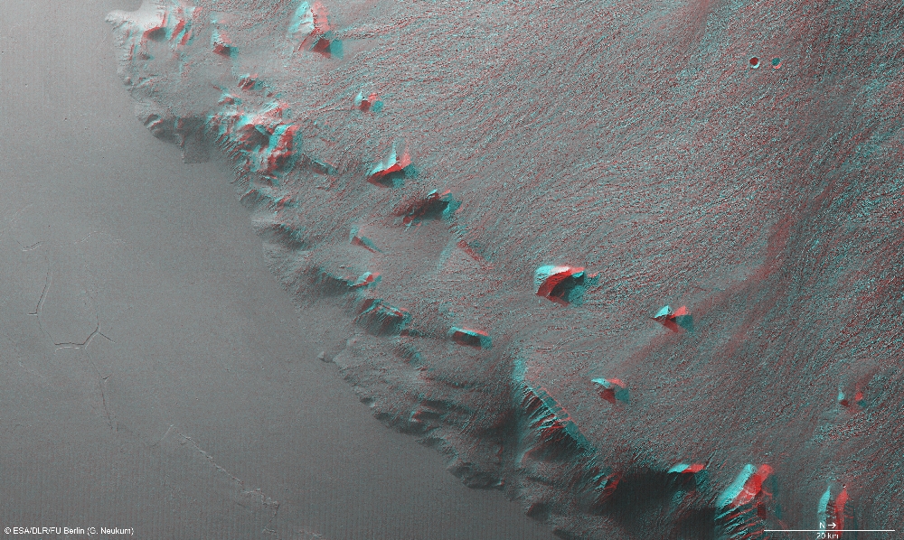
Image processing and the HRSC experiment on Mars Express
The images were acquired by the HRSC on 21 January 2013 during Mars Express Orbit 11,524 at approximately 14 degrees north and 229 degrees east. The ground resolution is about 17 metres per pixel. The colour image (4) was captured using the nadir channel, which is directed vertically down onto the surface of Mars, and the colour channels of the HRSC; the perspective oblique views (1, 5) were computed from data acquired by the HRSC stereo channels. The anaglyph image (6), which creates a three-dimensional impression of the landscape when viewed with red/blue or red/green glasses, was derived from the nadir channel and one stereo channel. The aerial view, encoded in rainbow colours (3), is based on a digital terrain model of the region, from which the topography of the landscape can be derived.
The HRSC camera experiment on board the European Space Agency's Mars Express mission is headed by Principal Investigator (PI) Professor Gerhard Neukum (Freie Universität Berlin), who was also responsible for the technical design of the camera. The science team consists of 40 co-investigators from 33 institutions in 10 nations. The camera was developed at DLR under the leadership of the PI and it was built in cooperation with industrial partners EADS Astrium, Lewicki Microelectronic GmbH and Jena-Optronik GmbH. The instrument is operated by the DLR Institute of Planetary Research in Berlin-Adlershof. The systematic processing of the HRSC image data is carried out at DLR. The images shown here were created by the Institute of Geological Sciences at Freie Universität Berlin in cooperation with the DLR Institute of Planetary Research, Berlin.
Download
hochaufgelöste Bilddaten / high resolution image data
| Context Map [2]: |
| Color-coded elevation model [3]: |
| RGB Colour Image [4]: |
| Perspective view [1]: |
| Perspective view #2 [6]: |
| Red-cyan Anaglyph [5]: |
© Copyright: ESA/DLR/FU Berlin (G. Neukum)