 Deutsch

Navigation/Menü: Links auf weitere Seiten dieser Website und Banner
02.05.2013
Landslides and lava flows at Olympus Mons
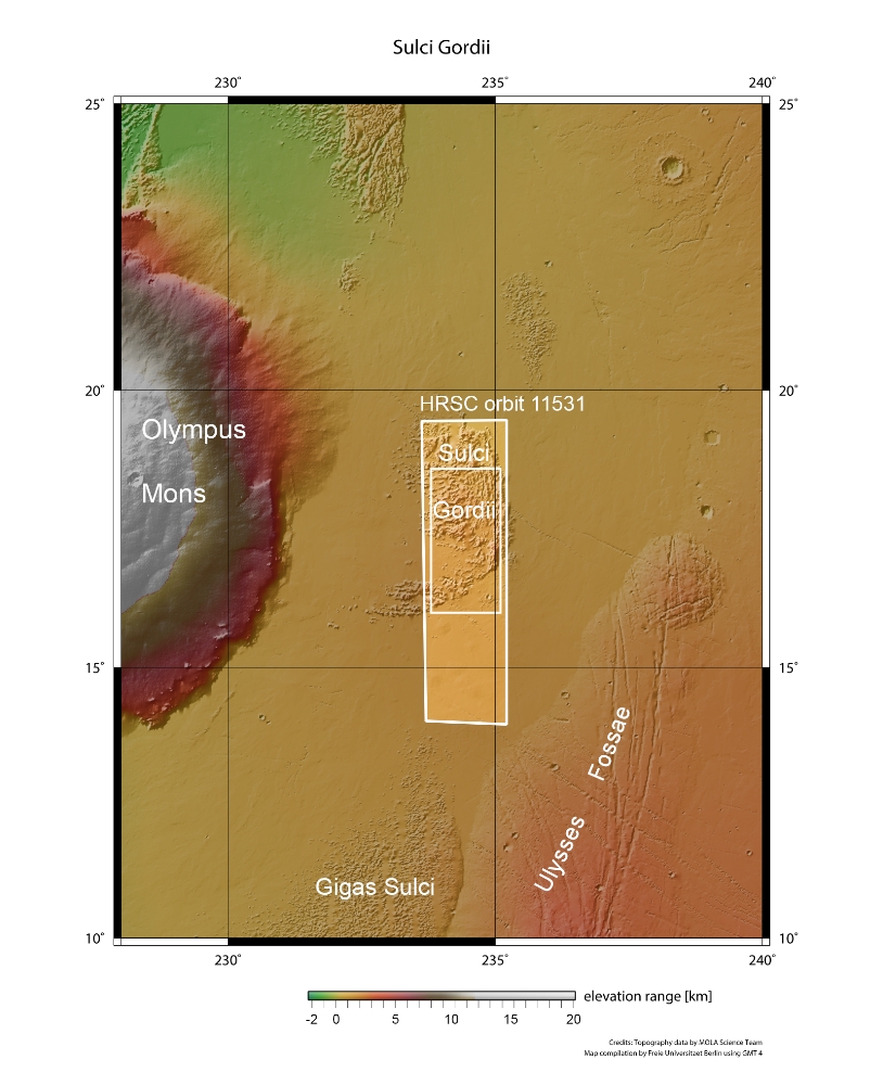
Giant landslides, lava flows, and tectonic forces are behind the dynamic scene captured in this recent image by ESAâs Mars Express of a region scarred by the solar systemâs largest volcano, Olympus Mons. The image was taken by the High Resolution Stereo Camera (HRSC) on board ESAâs Mars Express on 23 January 2013 (orbit 11531), with a ground resolution of approximately 31 metres per pixel. Sulci Gordii lies at approximately 17°N / 234°E, about 200 km east of Olympus Mons.
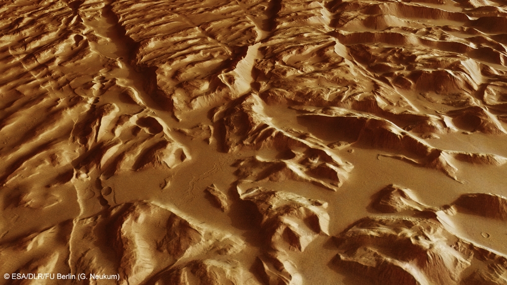
Sulci Gordii is a so-called âaureoleâ deposit â from the Latin for âcircle of lightâ â and is one of many such features that form a broken ring around the giant volcano, as hinted at in the context map. The aureoles tell the story of the catastrophic collapse of the lower flanks of Olympus Mons that occurred in its distant past. Today, it stands with steep cliff edges that rise 2 km above the surrounding plains. The collapse was brought about by weakening in the rocks supporting the volcanic edifice, which was perhaps influenced by the presence of subsurface water. During the collapse, rocky debris slid down and out over hundreds of kilometres of the surrounding volcanic plains, giving rise to the rough textured aureole seen today.
Similar avalanches of debris are also seen surrounding some volcanoes on Earth, including Mauna Loa in Hawaiâi, which, like Olympus Mons, is a smooth-sided âshieldâ volcano built up from successive lava flows. The smooth plains surrounding Sulci Gordii suggests that after the massive landslide happened, it was partially buried by subsequent lava flows. Indeed, faint outlines of ancient lava flows can be seen by zooming into the upper centre-left portion of the lead high-resolution image.
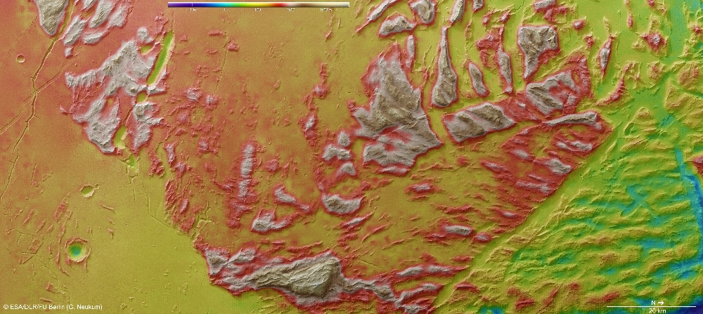
In rougher terrain towards the south (top centre-right of the main image), extensional tectonic forces have torn apart the martian crust, most clearly visible in the colour-coded topography map.
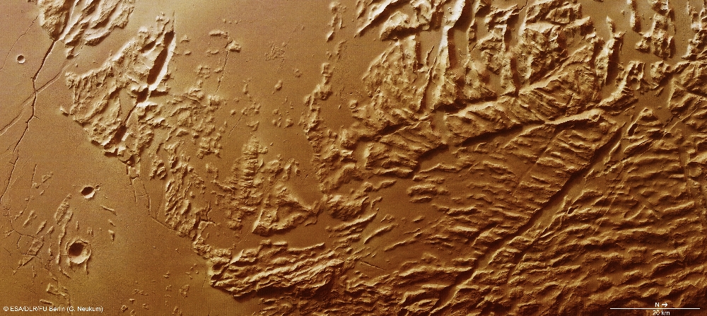
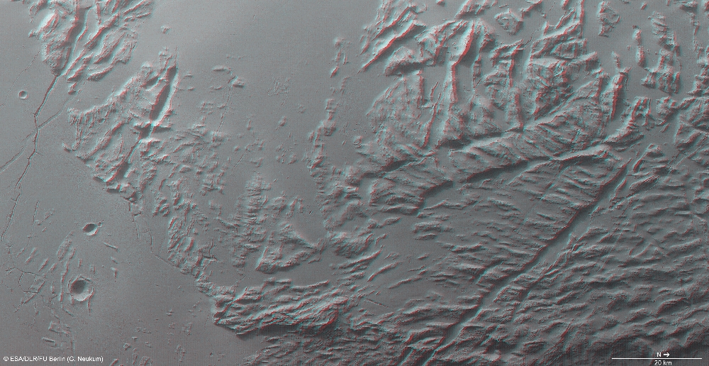
The characteristic corrugated appearance of the sulci â a geological term used to describe roughly parallel hills and valleys on Mars â likely resulted during the landslide as material slid away from the volcano and became compressed or pulled apart as it travelled across the surface. Over time, erosion of weaker material between the peaks accentuated this effect.The corrugated effect is best seen in the close-up perspective views. Zooming in on these images reveals that the hills and ridges are also covered by fine wind-blown dust, and that many small-scale landslides have occurred down the sides of the valleys between them.
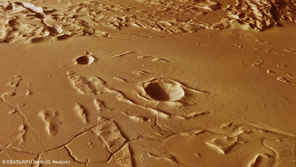
Similarly, on close inspection of the smooth plains, subtle ripples in the martian dust blanket can be seen. Here, thin undulating dunes have been whipped into shape by the prevailing wind. Numerous sinuous channels and jagged fracture networks also crisscross the scene, in particular at the southern (left) end of the main image and in close-up in the perspective view above. The channels range in length from around 50 to 300 km and were probably widened by short-lived lava flows, or perhaps even by water. An impressive sight on the left side of the perspective view is a sinuous channel that is suddenly truncated by a tectonic fault. Another channel running across the centre foreground has also clearly undergone a complex fracturing history.
By studying complex regions like this â and by comparing them to similar examples here on Earth â planetary scientists are able to learn more about the geological processes that dominated ancient Mars, when it was an active planet. Just as on Earth, the scene at Sulci Gordii tells us that volcanoes can undergo dramatic collapse events, facilitating the transport of vast quantities of material across hundreds of kilometres, where it is subsequently sculpted by wind, water and tectonic forces.
Image processing and the HRSC experiment on Mars Express
The images were acquired by the HRSC during Mars Express Orbit 11531. The image resolution is 31 metres per pixel. The colour image (4) was captured using the nadir channel, which is directed vertically down onto the surface of Mars, and the colour channels of the HRSC; the perspective oblique views (1, 5) were computed from data acquired by the HRSC stereo channels. The anaglyph image (6), which creates a three-dimensional impression of the landscape when viewed with red/blue or red/green glasses, was derived from the nadir channel and one stereo channel. The aerial view, encoded in rainbow colours (3), is based on a digital terrain model of the region, from which the topography of the landscape can be derived.
The HRSC camera experiment on board the European Space Agency's Mars Express mission is headed by Principal Investigator (PI) Professor Gerhard Neukum (Freie Universität Berlin), who was also responsible for the technical design of the camera. The science team consists of 40 co-investigators from 33 institutions in 10 nations. The camera was developed at DLR under the leadership of the PI and it was built in cooperation with industrial partners EADS Astrium, Lewicki Microelectronic GmbH and Jena-Optronik GmbH. The instrument is operated by the DLR Institute of Planetary Research in Berlin-Adlershof. The systematic processing of the HRSC image data is carried out at DLR. The images shown here were created by the Institute of Geological Sciences at Freie Universität Berlin in cooperation with the DLR Institute of Planetary Research, Berlin.
Download
hochaufgelöste Bilddaten / high resolution image data
| Context Map [2]: |
| Color-coded elevation model [3]: |
| RGB Colour Image [4]: |
| Perspective view [1]: |
| Perspective view #2 [6]: |
| Red-cyan Anaglyph [5]: |
© Copyright: ESA/DLR/FU Berlin (G. Neukum)